
Hide
Dinnington
hide
Hide
hide
Hide
Hide
Hide
"DINNINGTON is a parish, comprising the townships of Brenkley, Dinnington, Horton Grange, Mason, Prestwick, and Woolsington. It comprises an area of 5,538 acres; And its population in 1801, was 560; in 1811, 577; in 1821, 626; in 1831, 819; in 1841, 730; and in 1851 668 souls. Dinnington was formerly a part of the parish of Ponteland." [From History, Topography, and Directory of Northumberland, Whellan, 1855].
Hide
- Northumberland County Record Office holds copies of Census Returns 1841 - 1891 and provides a useful User Guide
- The 1851 Census Index (microfiche CN14)
- 1891 Census Ponteland 1B (Coxlodge, Fawdon, East and West Brunton, Kenton, Dinnington, Mason, Brenkley, Prestwick, Woolsington, Horton Grange, Kirley and Berwick Hill) (PRO piece RG12/4241) (Type B) (Book) (Volume 51) BOTH published by the https://www.ndfhs.org.uk/ may be of value to researchers interested in this parish.
- The Ancestral Indexes website provides information about Milbourne, Holy Saviour.
- Dinnington - Church Records - links and information.
- This area is divided between Northumberland Central Registration District and Newcastle upon Tyne Registration District.
- Birth Death and Marriage Cerificates can be ordered from Northumberland County Council
- Newcastle - Information. Searches.
- The section of The National Gazetteer (1868) relating to this parish - transcribed by Colin Hinson.
- Ask for a calculation of the distance from Dinnington to another place.
- The history of Dinnington Parish (originally part of Ponteland Parish) is included in:- Northumberland County History Committee, History of Northumberland, Volume 12. Newcastle, A. Reid, 1926. (Available on fiche from Ancestral Indexes).
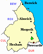
- Dinnington - Maps - links and information.
You can see maps centred on OS grid reference NZ203740 (Lat/Lon: 55.059651, -1.684042), Dinnington which are provided by:
- OpenStreetMap
- Google Maps
- StreetMap (Current Ordnance Survey maps)
- Bing (was Multimap)
- Old Maps Online
- National Library of Scotland (Old Ordnance Survey maps)
- Vision of Britain (Click "Historical units & statistics" for administrative areas.)
- English Jurisdictions in 1851 (Unfortunately the LDS have removed the facility to enable us to specify a starting location, you will need to search yourself on their map.)
- Magic (Geographic information) (Click + on map if it doesn't show)
- GeoHack (Links to on-line maps and location specific services.)
- All places within the same township/parish shown on an Openstreetmap map.
- Nearby townships/parishes shown on an Openstreetmap map.
- Nearby places shown on an Openstreetmap map.
- A transcript of Brunswick War Memorial provided by Ancestral Indexes.
Lest We Forget
Dinnington St Matthew Churchyard
22 Jun1918 Ernest Harris, Stoker 2nd Class SS/118419 RN, HMS Victory ll, age 18 son of John and Elizabeth Ann of Dinnington [grave North Section]
6 October 1942 Richard Brewis, Sapper 2017723 579 Army Field Coy. Royal Engineers, age 22 son of John Richard and Elizabeth brewis of Morpeth [grave New ground Row 1 grave 1]