
Hide
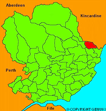
Logie-Pert
hide
Hide
"A parish in Forfarshire, formed by the union of the parishes of Logie and Pert; is situated on the North Esk river, and is of oblong shape, 4 miles in length by 3 in breadth. The soil on the banks of the river, is a deep clay, yielding, though uncultivated, plenty of natural grass. The higher grounds are partly loam, and partly of a black muirish cast, on a cold till bottom. It contains 3860 acres, of which 1850 are cultivated, 770 under wood, and the remainder waste and uncultivated. There are two extensive bleachfields; one on the estate of Logie, and the other on Craigo. Here are several mansion houses; of which Inglismaldie, a seat of the Earl of Kintore, and Craigo, the seat of Mr Carnegie, are the principal. Near Inglismaldie, is an eminence called Rosehill, the property of the Earl of Northesk, from which that family takes the second title of Baron."
The Gazetteer of Scotland, W Chalmers, Dundee 1803.
Hide
| Logie-Pert Parish Church, Logie-Pert, Church of Scotland |
- The transcription of the section for Logie Pert from the National Gazetteer (1868) provided by Colin Hinson.
- Ask for a calculation of the distance from Logie-Pert to another place.
You can see maps centred on OS grid reference NO672639 (Lat/Lon: 56.765622, -2.538789), Logie-Pert which are provided by:
- OpenStreetMap
- Google Maps
- StreetMap (Current Ordnance Survey maps)
- Bing (was Multimap)
- Old Maps Online
- National Library of Scotland (Old Ordnance Survey maps)
- Vision of Britain (Click "Historical units & statistics" for administrative areas.)
- Magic (Geographic information) (Click + on map if it doesn't show)
- GeoHack (Links to on-line maps and location specific services.)
- All places within the same township/parish shown on an Openstreetmap map.
- Nearby townships/parishes shown on an Openstreetmap map.
- Nearby places shown on an Openstreetmap map.